Built for Surveyors. 12d Synergy + Leica Geosystems
Seamless field-to-office workflows across Captivate, iCON, Infinity, ConX and HxGN GeoCloud with governed dataflows, ISO 19650 compliance and end-to-end version control.
How 12d Synergy and Leica Geosystems Work Together to Streamline Survey Data and Project Workflows
True End-to-End Workflow for Surveyors
Stop wasting time on USB transfers and email chains. Leica Geosystems’ integration with 12d Synergy enables bi-directional data flows, ensuring real-time access to the latest designs and survey data.
Built for Work In Progress (WIP) Management
Unlike traditional CDEs, 12d Synergy supports surveyors as active participants in the WIP phase, bridging the disconnect between field data and design processes.
Confidence Through Control and Compliance
With version control, audit trails, and ISO 19650-ready workflows, survey teams gain transparency and traceability from capture to completion.
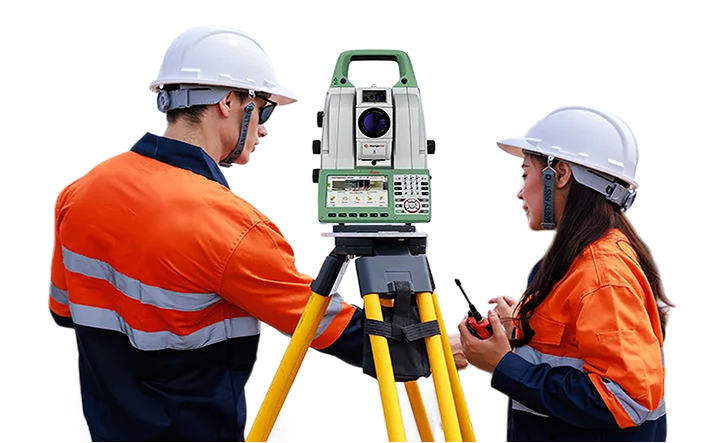
Integrate Leica Geosystems to Eliminate Manual Data Transfers
Transform disconnected survey workflows into a single source of truth with Leica Geosystems’ native connector to 12d Synergy.
The Leica Geosystems–12d Synergy integration, now in Leica Infinity, streamlines data flow between field and office by linking Leica Infinity, Leica ConX, HxGN GeoCloud, Leica Captivate, and Leica iCON with 12d Synergy’s Common Data Environment. It eliminates manual uploads and versioning issues, ensuring teams always work with the latest files. Field data flows directly to design teams—boosting collaboration and efficiency.
Key Features to help control and manage your project information
Bi-directional Sync
Integrates with 12d Model,
BricsCAD & More
Auto Check-in/Out for
Version Control
ISO 19650-Ready Audit Trails
Supports Leica Captivate, Leica iCON, Leica ConX & HxGN GeoCloud
Minimises Duplication & Rework
Cloud-Connected – No USBs or Manual Uploads
Improves Survey-Team Collaboration
Structured WIP Data Management
Optimised Geospatial Performance Over Networks
Template-Based Project Creation
Smart, Incremental Data Sync
Local Performance, Cloud Control
Reliable Check-In/Check-Out
Strong relationship
with Leica Geosystems
“We’ve always had a strong relationship with Leica Geosystems, and this partnership marks an exciting new chapter. Together, we’re delivering more efficient workflows, driving innovation, and building stronger, data-agnostic solutions. Our businesses share a commitment to providing best-fit solutions that truly serve our customers’ needs.”
Bring Control and Clarity to your Survey Data
Discover how 12d Synergy helps surveyors manage Work In Progress (WIP) projects with version control, audit trails, and seamless collaboration across teams.
Power Your Field Teams with Leica Geosystems’ Connected Tools
Leverage Leica Infinity, Leica ConX, HxGN GeoCloud, and Leica Captivate to streamline your survey workflows—from capture to design—with smart, reliable hardware and software.
12d Synergy is trusted by:
