All-in-one solution for surveyors and civil engineering professionals
Experience 12d’s end-to-end data agnostic solution that supports you throughout the project lifecycle. From precise data collection to advanced design capabilities and efficient information management.
Surveying shouldn’t feel like a juggling act between clunky tools, data silos, and long days in the field.
That’s why 12d products are purpose-built to give surveyors the freedom to collect, share, and act on data in real-time. From field to finish, our connected solution helps you work smarter, faster, and with confidence.
A Better Way to Survey
Experience 12d’s end-to-end data agnostic solution that supports you throughout the project lifecycle. From precise data collection to advanced design capabilities and efficient information management.
Seamless field-to-office workflows.
Flip to Learn More ⧉
Leverage 12d Model and 12d Field’s Master Shares to deliver real-time design updates directly to the field, ensuring surveyors and field crews are always working with the latest, most accurate information. Seamlessly connect with other field systems, such as Leica Captivate and iCON, through CDE Connect and Leica ConX or GeoCloud Drive.
One Source of Truth, Zero Rework
Flip to Learn More ⧉
12d Synergy provides an ISO 19650 compliant common data environment, consolidating design data, communications, and workflows into a managed system that improves traceability, reduces rework, and maintains data integrity across the project lifecycle.
Open and Data-Agnostic
Flip to Learn More ⧉
With a platform-agnostic framework, 12d Synergy enables secure storage, sharing, and control of data from any software ecosystem. This approach promotes interoperability, reduces manual handling, and maintains data integrity throughout the digital project lifecycle.
Audit Trails and Change Tracking
Flip to Learn More ⧉
With built-in version control and quality assurance, 12d Synergy maintains a complete, traceable record of all revisions. Quality assurance processes are embedded into the workflow, enabling real-time validation, reduced rework, and full accountability across all project stages.
Unify Surveying, Design and BIM Data
Flip to Learn More ⧉
12d Synergy provides a connected, data-agnostic platform that brings together surveying, design, and BIM information from a range of authoring tools. Teams can continue using their existing software stack while 12d Synergy centralises the access, versioning, and QA of data and deliverables in a common data environment—ensuring a single, reliable source of project truth.

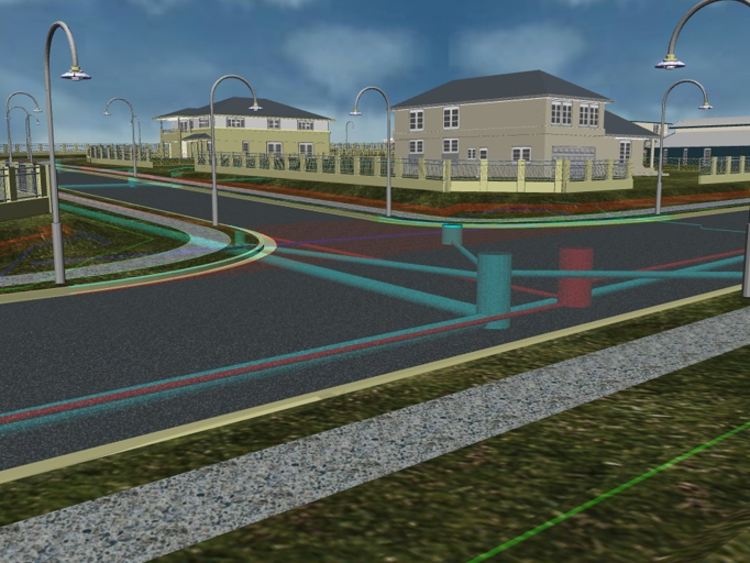
An example of a workflow with 12d Synergy
Built by Surveyors, for Surveyors
We understand the pressures of tight deadlines, evolving designs, and rugged Field conditions. That’s why 12d is engineered to support you with
Scale with Confidence
Handle large, complex datasets across multiple teams without lag or loss. 12d Synergy is built to scale with your project, no matter the size.

One Source of Truth for Survey Data
Centralise your native projects, files, and field data in a structured environment accessible to surveyors, designers, and stakeholders.
Built-in Quality Assurance & Version Control
Maintain full audit trails, manage versions, and automate checks to catch issues early and ensure compliance.
Full Field-to-Finish Workflows
Link everyone from surveyors, designers, and stakeholders in one data environment for end-to-end project success
Your all in one civil solution
Comprehensive surveying, civil, utilities and water design tools.
Automate Tasks with Custom Macros
Streamline your workflows with a number of different tools including custom macros and chains
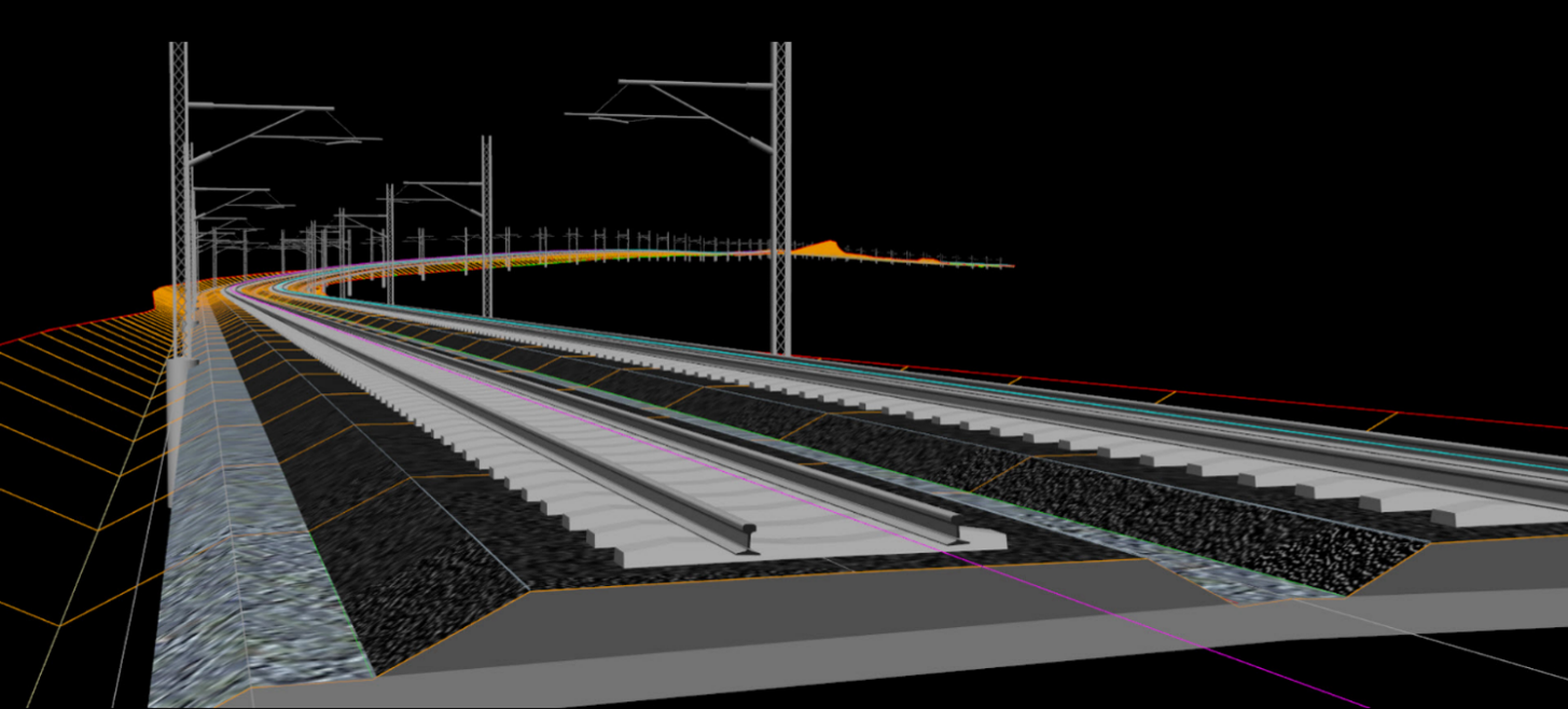
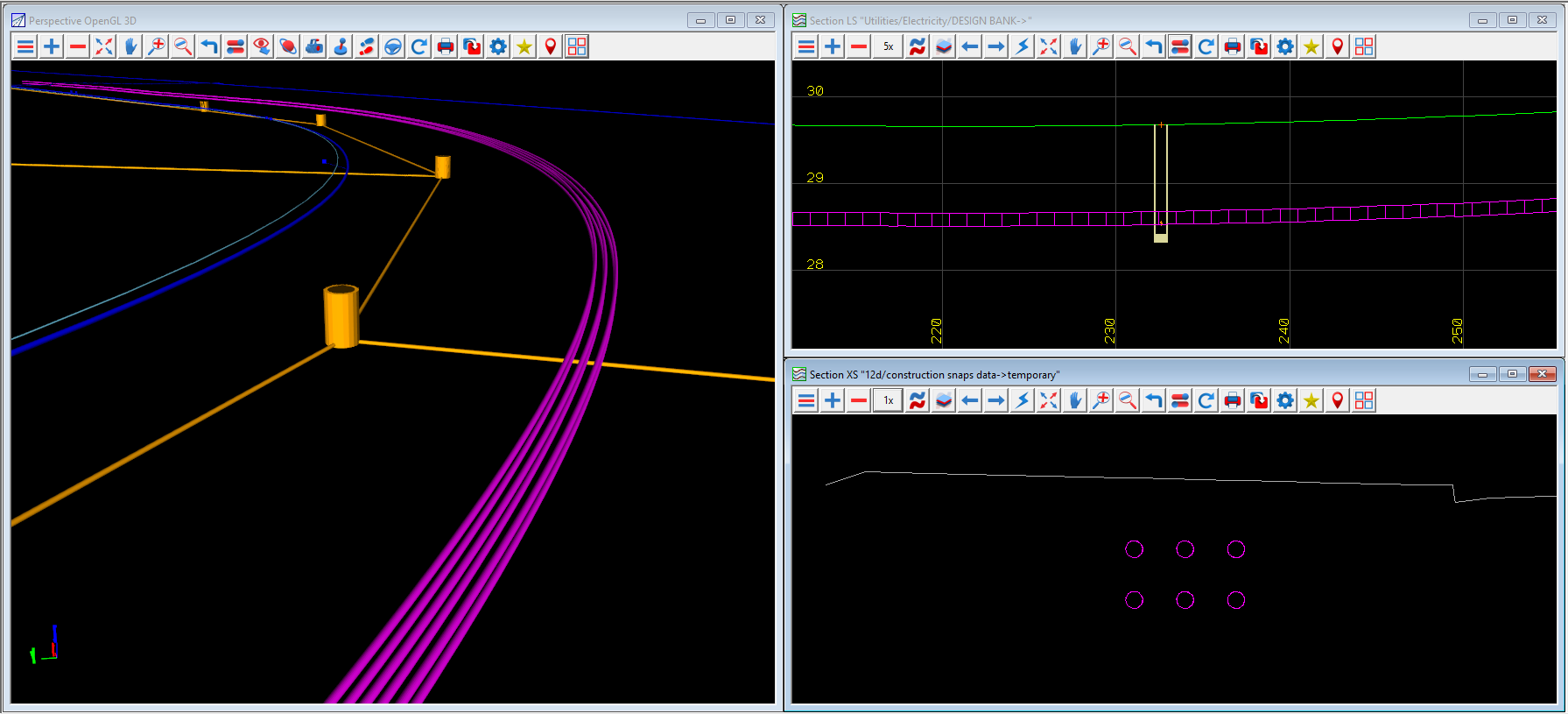
Enter the world of "Civil BIM"
Seamless enter the world of Civil BIM with intelligent, information-rich data for smarter design and collaboration
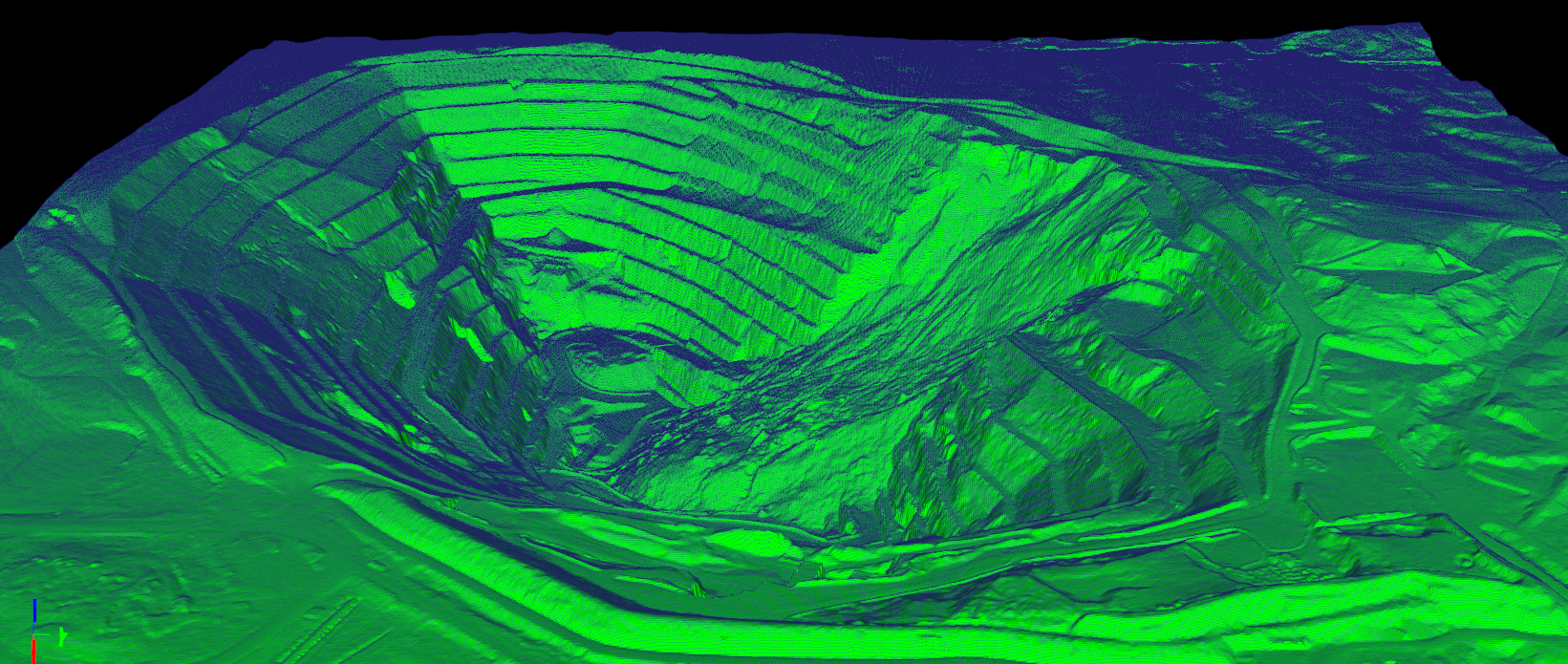
Power and performance on the largest of scales
12d model effortlessly manages and processes large, complex datasets with speed, stability and precision
Comprehensive Adjustment Tools
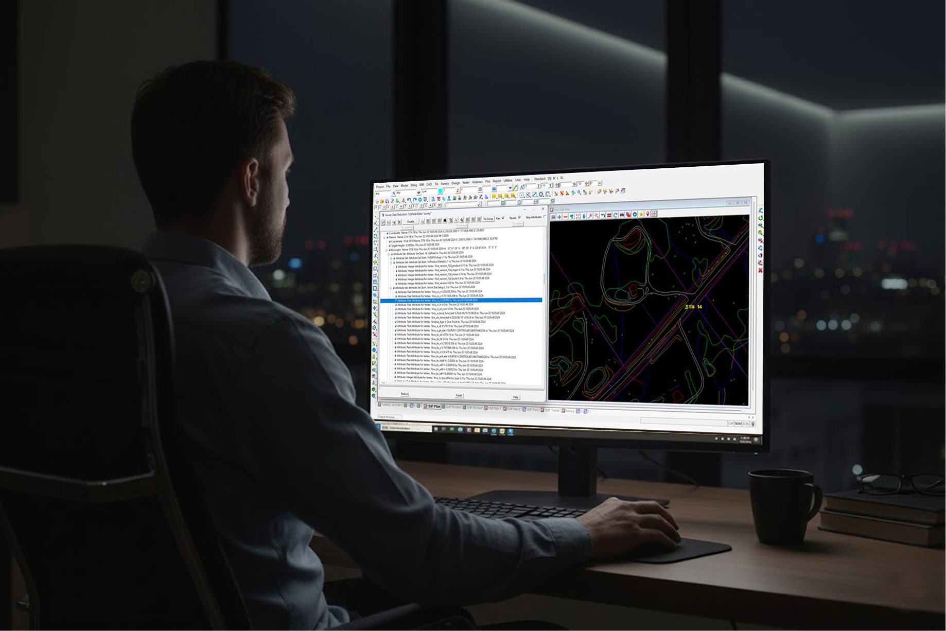
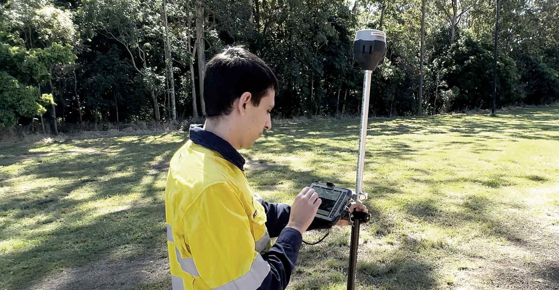
12d Field provides a full suite of adjustment and coordinate transformation tools, enabling reliable surveys without returning to the office
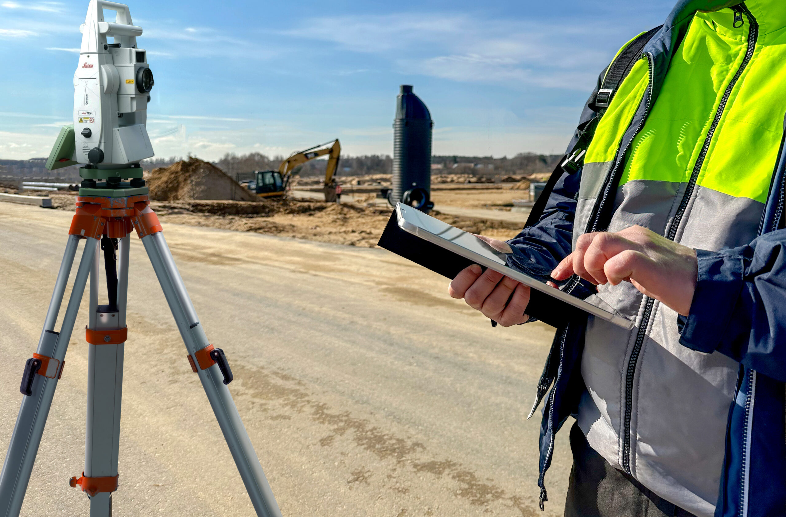
Connect Field & Office
Stream live design from office 12d model projects to your tablet on site, and vice versa
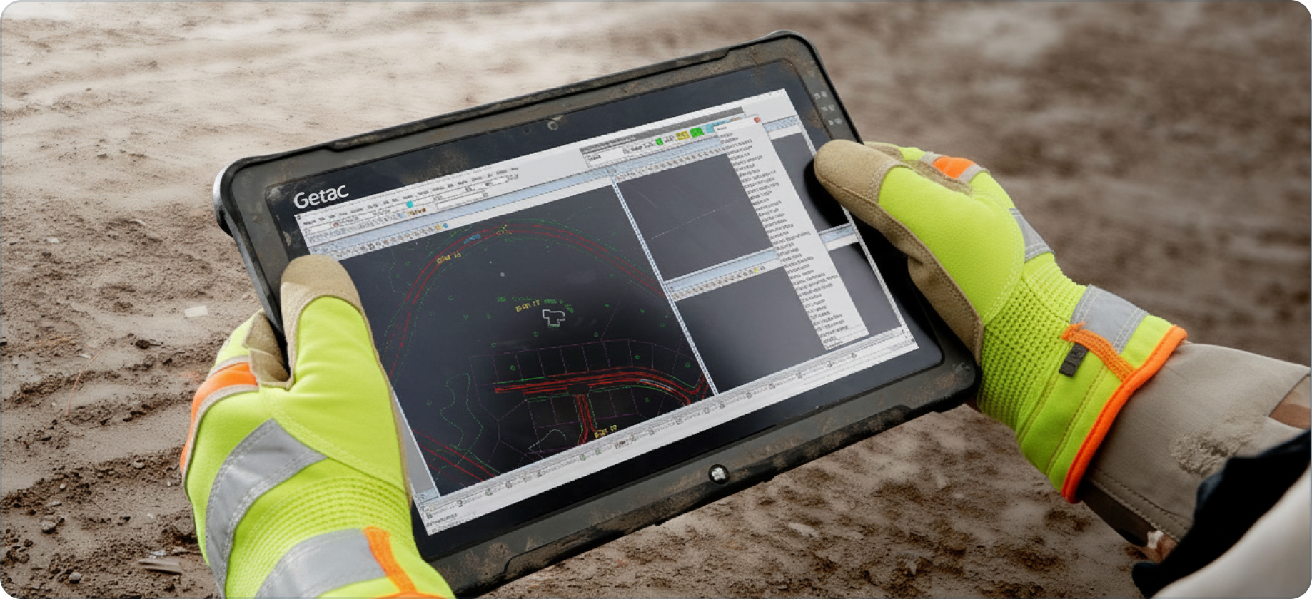
An Agnostic Capture Solution
Take 12d model to site with 12d field, and connect seamlessly to a wide range of manufacturer's instruments
Bring your surveys to life
Use intelligent mapfiles that easily turn strings and points into complex 3d BIM objects
Discover our Product Ecosystem

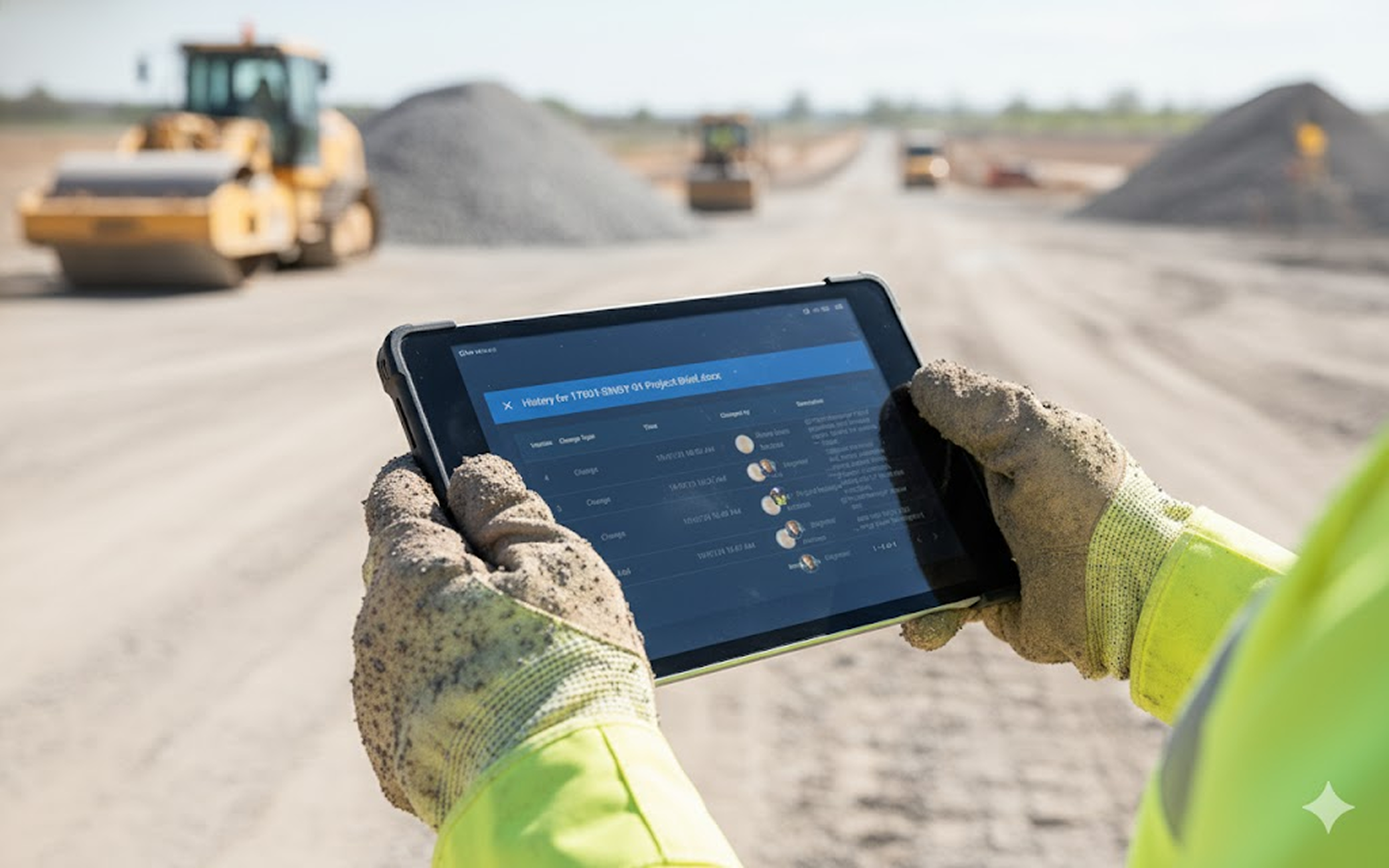
12d Field
Real-time field-to-office data made simple.
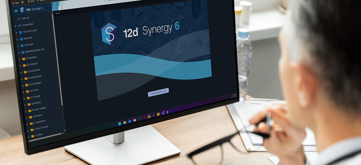
12d Synergy
12d Synergy is an Information Management and Collaboration solution.
CDE Connect
CDE Connect – connect with the CDEs and platforms you already use.

Connect Your Ecosystem
Streamline Survey Data and Project Workflows
Trusted by the best in the industry
Step into the world of 12d, where every detail is meticulously crafted to help you unlock the full potential of BIM and take your projects to new heights of success.


12d for everyone in the project lifecycle


Resources

How Australia’s deepest tunnelled motorway blitzed the brief
So how did NorthConnex deliver a successful, award-winning, cost-effective and high-quality project within tight timeframes?

Delivering Victoria’s Largest Tunnel Project
This webinar takes a deep dive into the application of 12d Synergy and 12d Model in the North East Link project, one of Australia’s largest infrastructure projects.

Interview with Mainland Surveying
We caught up with Scott Williams, Managing Director of Mainland Surveying. The Surveying firm first adopted 12d Synergy in 2013. Scott was good enough to share his experiences with the product in this interview.